
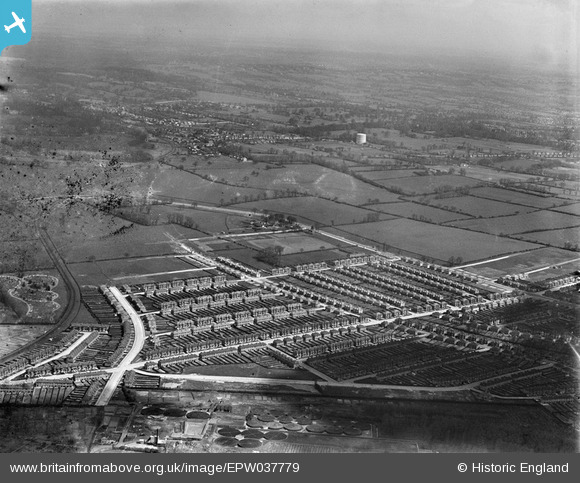
EPW037779 ENGLAND (1932). Housing estate centred upon Christchurch Avenue, Kenton, from the south, 1932
© Copyright OpenStreetMap contributors and licensed by the OpenStreetMap Foundation. 2026. Cartography is licensed as CC BY-SA.
Nearby Images (5)
EPW037779

EPW037776

EPW037775

EPW037778

EPW037781

Details
| Title | [EPW037779] Housing estate centred upon Christchurch Avenue, Kenton, from the south, 1932 |
| Reference | EPW037779 |
| Date | May-1932 |
| Link | |
| Place name | KENTON |
| Parish | |
| District | |
| Country | ENGLAND |
| Easting / Northing | 516680, 189646 |
| Longitude / Latitude | -0.31538988489934, 51.593091172305 |
| National Grid Reference | TQ167896 |
