
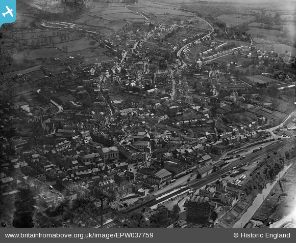
EPW037759 ENGLAND (1932). The railway station and the town, Stroud, 1932
© Copyright OpenStreetMap contributors and licensed by the OpenStreetMap Foundation. 2026. Cartography is licensed as CC BY-SA.
Nearby Images (5)
EPW037759

EPW037756

EPW023881

EPW023880

EPW037758

Details
| Title | [EPW037759] The railway station and the town, Stroud, 1932 |
| Reference | EPW037759 |
| Date | May-1932 |
| Link | |
| Place name | STROUD |
| Parish | STROUD |
| District | |
| Country | ENGLAND |
| Easting / Northing | 385293, 205099 |
| Longitude / Latitude | -2.2130372660146, 51.7439438047 |
| National Grid Reference | SO853051 |
Pins
Be the first to add a comment to this image!