
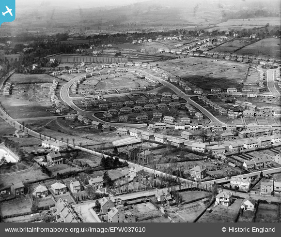
EPW037610 ENGLAND (1932). The Sutton Farm housing estate, Kidderminster, 1932
© Copyright OpenStreetMap contributors and licensed by the OpenStreetMap Foundation. 2025. Cartography is licensed as CC BY-SA.
Nearby Images (2)
EPW037610

EPW037609

Details
| Title | [EPW037610] The Sutton Farm housing estate, Kidderminster, 1932 |
| Reference | EPW037610 |
| Date | April-1932 |
| Link | |
| Place name | KIDDERMINSTER |
| Parish | |
| District | |
| Country | ENGLAND |
| Easting / Northing | 382007, 275485 |
| Longitude / Latitude | -2.2643457241946, 52.376727414997 |
| National Grid Reference | SO820755 |
Pins

NickY |
Wednesday 22nd of February 2023 08:21:40 AM | |
|
NickY |
Wednesday 22nd of February 2023 08:17:21 AM | |
|
NickY |
Wednesday 22nd of February 2023 08:14:37 AM |