
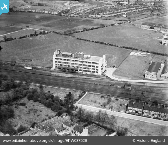
EPW037528 ENGLAND (1932). Wrigley's Chewing Gum Factory, Wembley, 1932
© Copyright OpenStreetMap contributors and licensed by the OpenStreetMap Foundation. 2026. Cartography is licensed as CC BY-SA.
Nearby Images (11)
EPW037528

EPW037529

EPW017342

EPW020194

EPW020194
EPW020343

EPW020343
EPW020193

EPW020193
EPW037531

EPW037530

Details
| Title | [EPW037528] Wrigley's Chewing Gum Factory, Wembley, 1932 |
| Reference | EPW037528 |
| Date | April-1932 |
| Link | |
| Place name | WEMBLEY |
| Parish | |
| District | |
| Country | ENGLAND |
| Easting / Northing | 517570, 186611 |
| Longitude / Latitude | -0.30356252700235, 51.565626194683 |
| National Grid Reference | TQ176866 |
Pins

BOCMichael |
Tuesday 3rd of August 2021 12:04:39 AM |