
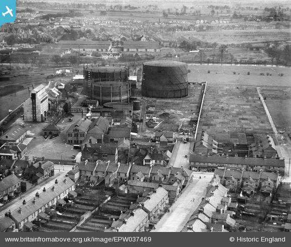
EPW037469 ENGLAND (1932). The Bedford Gas Works and housing off Ford End Road, Bedford, 1932
© Copyright OpenStreetMap contributors and licensed by the OpenStreetMap Foundation. 2026. Cartography is licensed as CC BY-SA.
Nearby Images (9)
EPW037469

EPW037467

EPW037468

EPW037462

EPW037470

EPW037465

EPW037463

EPW037464

EPW037466

Details
| Title | [EPW037469] The Bedford Gas Works and housing off Ford End Road, Bedford, 1932 |
| Reference | EPW037469 |
| Date | April-1932 |
| Link | |
| Place name | BEDFORD |
| Parish | |
| District | |
| Country | ENGLAND |
| Easting / Northing | 504080, 249279 |
| Longitude / Latitude | -0.47926338488622, 52.131590626155 |
| National Grid Reference | TL041493 |
Pins

melgibbs |
Tuesday 14th of January 2014 05:08:11 PM | |
|
melgibbs |
Tuesday 14th of January 2014 05:06:59 PM | |
|
melgibbs |
Friday 3rd of May 2013 09:50:02 PM | |
|
melgibbs |
Friday 3rd of May 2013 09:49:34 PM | |
|
melgibbs |
Friday 3rd of May 2013 09:48:33 PM | |
|
melgibbs |
Friday 3rd of May 2013 09:47:51 PM | |
|
melgibbs |
Friday 3rd of May 2013 09:47:23 PM | |
|
melgibbs |
Friday 3rd of May 2013 09:45:47 PM | |

Class31 |
Sunday 17th of February 2013 03:43:58 PM |