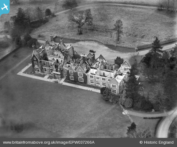
EPW037266A ENGLAND (1932). Steventon Manor being rebuilt after fire, Steventon, 1932
© Copyright OpenStreetMap contributors and licensed by the OpenStreetMap Foundation. 2026. Cartography is licensed as CC BY-SA.
Details
| Title | [EPW037266A] Steventon Manor being rebuilt after fire, Steventon, 1932 |
| Reference | EPW037266A |
| Date | February-1932 |
| Link | |
| Place name | STEVENTON |
| Parish | STEVENTON |
| District | |
| Country | ENGLAND |
| Easting / Northing | 455013, 147193 |
| Longitude / Latitude | -1.2121745005663, 51.220763697981 |
| National Grid Reference | SU550472 |
Pins
Be the first to add a comment to this image!
User Comment Contributions
The building that stands on the site today seems to have a different foot print. |

Maurice |
Friday 5th of April 2013 09:23:58 AM |
According to Matthew Beckett the house was demolished in 1970...The entry continues "following damage in World War II" see http://lh.matthewbeckett.com/houses/lh_hampshire_steventonmanor_info_gallery.html |

Class31 |
Friday 5th of April 2013 09:23:58 AM |


![[EPW037266A] Steventon Manor being rebuilt after fire, Steventon, 1932](http://britainfromabove.org.uk/sites/all/libraries/aerofilms-images/public/100x100/EPW/037/EPW037266A.jpg)
![[EPW037267] Steventon Manor being rebuilt after fire, Steventon, 1932](http://britainfromabove.org.uk/sites/all/libraries/aerofilms-images/public/100x100/EPW/037/EPW037267.jpg)
![[EPW037268] Steventon Manor being rebuilt after fire, Steventon, 1932](http://britainfromabove.org.uk/sites/all/libraries/aerofilms-images/public/100x100/EPW/037/EPW037268.jpg)
![[EPW037269] Steventon Manor being rebuilt after fire, Steventon, 1932](http://britainfromabove.org.uk/sites/all/libraries/aerofilms-images/public/100x100/EPW/037/EPW037269.jpg)