
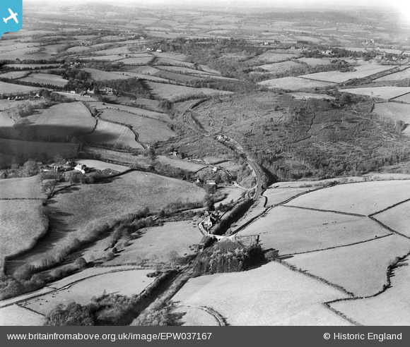
EPW037167 ENGLAND (1931). The Tunbridge Wells and Hastings Branch Railway, Snape Wood and environs, Wadhurst Park, from the south-east, 1931
© Copyright OpenStreetMap contributors and licensed by the OpenStreetMap Foundation. 2026. Cartography is licensed as CC BY-SA.
Nearby Images (2)
EPW037167

EPW037168

Details
| Title | [EPW037167] The Tunbridge Wells and Hastings Branch Railway, Snape Wood and environs, Wadhurst Park, from the south-east, 1931 |
| Reference | EPW037167 |
| Date | November-1931 |
| Link | |
| Place name | WADHURST PARK |
| Parish | WADHURST |
| District | |
| Country | ENGLAND |
| Easting / Northing | 563793, 129770 |
| Longitude / Latitude | 0.33678232239372, 51.04336509801 |
| National Grid Reference | TQ638298 |
Pins

Maurice |
Friday 8th of February 2013 07:40:43 AM | |

MB |
Thursday 7th of February 2013 11:26:20 PM | |
|
MB |
Thursday 7th of February 2013 11:23:20 PM | |
|
MB |
Thursday 7th of February 2013 11:20:32 PM | |
|
MB |
Thursday 7th of February 2013 11:18:46 PM | |
|
MB |
Thursday 7th of February 2013 11:18:28 PM | |
|
MB |
Thursday 7th of February 2013 11:16:07 PM | |
|
MB |
Thursday 7th of February 2013 11:15:46 PM | |
|
MB |
Thursday 7th of February 2013 11:12:59 PM | |
|
MB |
Thursday 7th of February 2013 11:12:06 PM | |
|
MB |
Thursday 7th of February 2013 11:11:36 PM | |
|
MB |
Thursday 7th of February 2013 11:10:28 PM | |
I think this is labelled incorrectly. The miner's arms is the first house on the left as you enter the lane from the road fork. In this picture it is hard to see as there is a large tree in front of it. |

Garry |
Monday 24th of June 2013 07:11:39 PM |
|
MB |
Thursday 7th of February 2013 11:09:34 PM |