
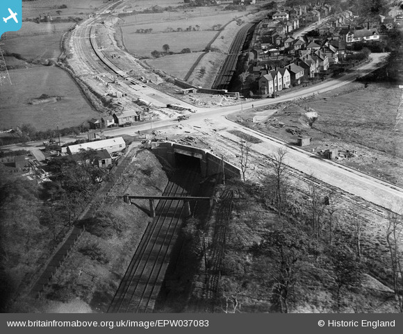
EPW037083 ENGLAND (1931). The East Lancashire Road (A580) under construction at the crossing with Walkden Road, Worsley, from the west, 1931
© Copyright OpenStreetMap contributors and licensed by the OpenStreetMap Foundation. 2026. Cartography is licensed as CC BY-SA.
Nearby Images (3)
EPW037083
 under construction at the crossing with Walkden Road, Worsley, from the west, 1931")
EPW037086
 under construction at the crossing with Walkden Road, Worsley, from the west, 1931")
EPW038564
 and environs, Worsley, from the south-west, 1932. This image has been produced from a damaged negative.")
Details
| Title | [EPW037083] The East Lancashire Road (A580) under construction at the crossing with Walkden Road, Worsley, from the west, 1931 |
| Reference | EPW037083 |
| Date | October-1931 |
| Link | |
| Place name | WORSLEY |
| Parish | |
| District | |
| Country | ENGLAND |
| Easting / Northing | 374043, 401753 |
| Longitude / Latitude | -2.3914616087118, 53.51156961781 |
| National Grid Reference | SD740018 |
Pins

Moonraker |
Friday 10th of November 2023 05:21:13 PM | |

Maurice |
Monday 9th of September 2013 04:40:29 PM | |
|
Maurice |
Monday 9th of September 2013 04:30:39 PM | |
|
Maurice |
Monday 9th of September 2013 04:28:33 PM | |
|
Maurice |
Monday 9th of September 2013 04:27:11 PM | |
|
MB |
Thursday 27th of December 2012 08:18:46 PM |
User Comment Contributions

Great road building shot. |
Katy Whitaker |
Monday 9th of September 2013 04:22:28 PM |