
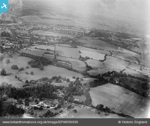
EPW036936 ENGLAND (1931). Purbright and the countryside between Hooley and Chipstead , Hooley, from the south-west, 1931
© Copyright OpenStreetMap contributors and licensed by the OpenStreetMap Foundation. 2025. Cartography is licensed as CC BY-SA.
Nearby Images (3)
EPW036936

EPW036966

EPW036967

Details
| Title | [EPW036936] Purbright and the countryside between Hooley and Chipstead , Hooley, from the south-west, 1931 |
| Reference | EPW036936 |
| Date | October-1931 |
| Link | |
| Place name | HOOLEY |
| Parish | |
| District | |
| Country | ENGLAND |
| Easting / Northing | 528085, 156249 |
| Longitude / Latitude | -0.16290055462655, 51.290442977352 |
| National Grid Reference | TQ281562 |
Pins
Be the first to add a comment to this image!