
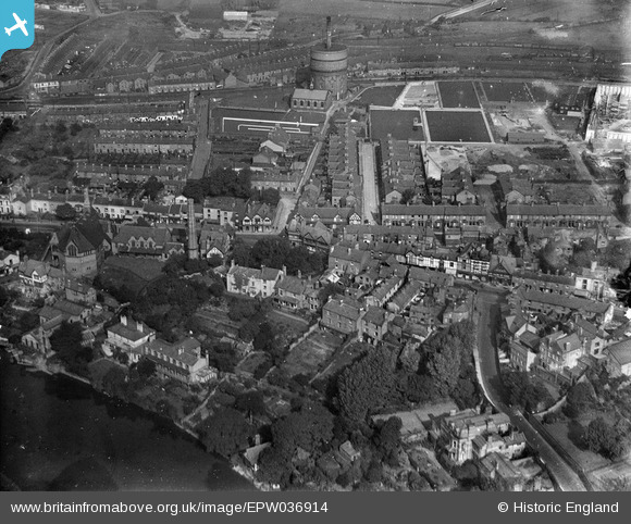
EPW036914 ENGLAND (1931). Chester Water Works and environs, Boughton, 1931
© Copyright OpenStreetMap contributors and licensed by the OpenStreetMap Foundation. 2026. Cartography is licensed as CC BY-SA.
Nearby Images (4)
EPW036914

EPW037221

EPW003096

EPW003099

Details
| Title | [EPW036914] Chester Water Works and environs, Boughton, 1931 |
| Reference | EPW036914 |
| Date | September-1931 |
| Link | |
| Place name | BOUGHTON |
| Parish | |
| District | |
| Country | ENGLAND |
| Easting / Northing | 341906, 366434 |
| Longitude / Latitude | -2.8695944733561, 53.191530628104 |
| National Grid Reference | SJ419664 |
Pins

Squirrelly |
Saturday 4th of April 2026 11:03:32 AM | |
|
Squirrelly |
Saturday 4th of April 2026 11:01:47 AM | |
|
staffsmod |
Thursday 3rd of October 2013 04:21:28 PM |