
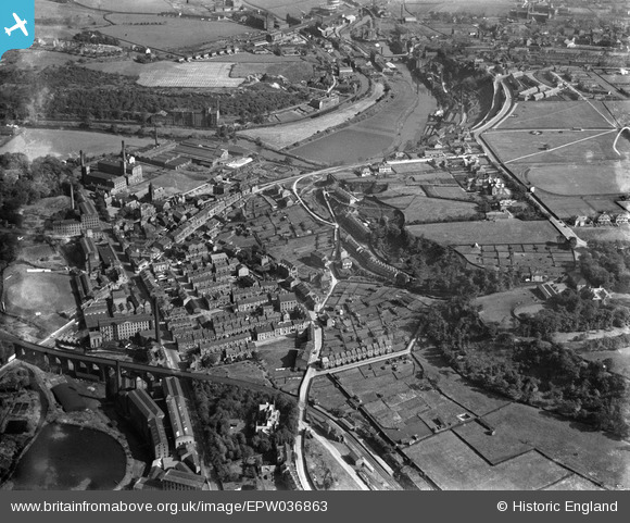
EPW036863 ENGLAND (1931). West Vale, Elland, 1931
© Copyright OpenStreetMap contributors and licensed by the OpenStreetMap Foundation. 2026. Cartography is licensed as CC BY-SA.
Nearby Images (2)
EPW036863

EPW036865

Details
| Title | [EPW036863] West Vale, Elland, 1931 |
| Reference | EPW036863 |
| Date | September-1931 |
| Link | |
| Place name | ELLAND |
| Parish | |
| District | |
| Country | ENGLAND |
| Easting / Northing | 409694, 420977 |
| Longitude / Latitude | -1.8532037779757, 53.684931092815 |
| National Grid Reference | SE097210 |
Pins

N166le |
Sunday 28th of March 2021 01:55:29 PM | |
|
N166le |
Sunday 28th of March 2021 01:54:21 PM | |
|
MB |
Tuesday 20th of September 2016 08:19:46 AM | |
|
sbutterworth |
Monday 19th of August 2013 12:21:45 PM |