
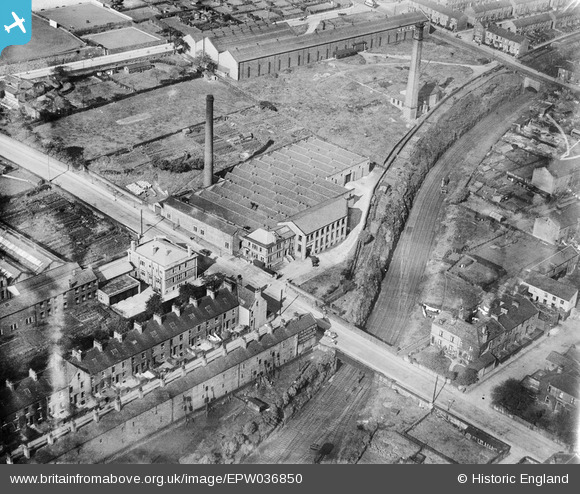
EPW036850 ENGLAND (1931). The Kingston Confectionery Works on Hopwood Lane, Halifax, 1931
© Copyright OpenStreetMap contributors and licensed by the OpenStreetMap Foundation. 2026. Cartography is licensed as CC BY-SA.
Nearby Images (23)
EPW036850

EPW036855

EPW036851

EPW036856

EPW036854

EPW036852

EPW036853

EAW004555

EAW028038

EAW004551

EAW028035

EAW028041

EAW028030

EAW028031

EAW028039

EAW004552

EAW028034

EAW028040

EAW004557

EAW004554

EAW004553

EAW004556

EAW004558

Details
| Title | [EPW036850] The Kingston Confectionery Works on Hopwood Lane, Halifax, 1931 |
| Reference | EPW036850 |
| Date | September-1931 |
| Link | |
| Place name | HALIFAX |
| Parish | |
| District | |
| Country | ENGLAND |
| Easting / Northing | 407766, 424916 |
| Longitude / Latitude | -1.8823006466526, 53.720371526414 |
| National Grid Reference | SE078249 |
