
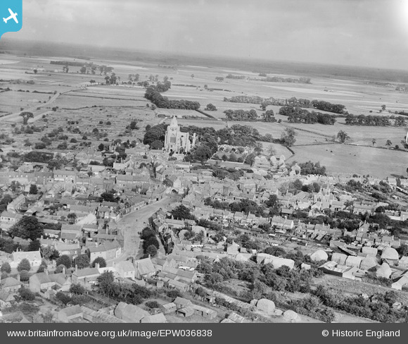
EPW036838 ENGLAND (1931). West Street and the Abbey, Crowland, from the south-west, 1931
© Copyright OpenStreetMap contributors and licensed by the OpenStreetMap Foundation. 2026. Cartography is licensed as CC BY-SA.
Nearby Images (3)
EPW036838

EPW036842

EPW036841

Details
| Title | [EPW036838] West Street and the Abbey, Crowland, from the south-west, 1931 |
| Reference | EPW036838 |
| Date | September-1931 |
| Link | |
| Place name | CROWLAND |
| Parish | CROWLAND |
| District | |
| Country | ENGLAND |
| Easting / Northing | 523871, 310173 |
| Longitude / Latitude | -0.16769916705503, 52.6747374021 |
| National Grid Reference | TF239102 |
Pins
Be the first to add a comment to this image!