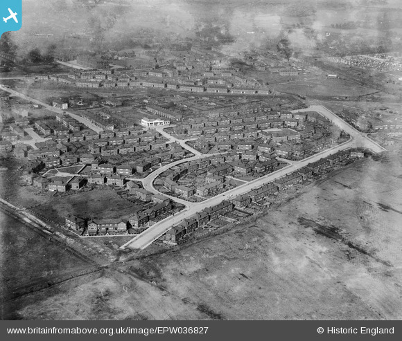
EPW036827 ENGLAND (1931). Housing estate to the east of Melland Playing Field, Gorton, 1931
© Copyright OpenStreetMap contributors and licensed by the OpenStreetMap Foundation. 2026. Cartography is licensed as CC BY-SA.
Nearby Images (9)
Details
| Title | [EPW036827] Housing estate to the east of Melland Playing Field, Gorton, 1931 |
| Reference | EPW036827 |
| Date | September-1931 |
| Link | |
| Place name | GORTON |
| Parish | |
| District | |
| Country | ENGLAND |
| Easting / Northing | 388691, 395115 |
| Longitude / Latitude | -2.1703154238849, 53.452416877949 |
| National Grid Reference | SJ887951 |
Pins
Be the first to add a comment to this image!


![[EPW036827] Housing estate to the east of Melland Playing Field, Gorton, 1931](http://britainfromabove.org.uk/sites/all/libraries/aerofilms-images/public/100x100/EPW/036/EPW036827.jpg)
![[EPW035592] Sandown Crescent and environs, Gorton, 1931](http://britainfromabove.org.uk/sites/all/libraries/aerofilms-images/public/100x100/EPW/035/EPW035592.jpg)
![[EPW036836] Housing estate adjacent to Melland Playing Field, Gorton, 1931](http://britainfromabove.org.uk/sites/all/libraries/aerofilms-images/public/100x100/EPW/036/EPW036836.jpg)
![[EPW035591] Sandown Crescent and environs, Gorton, 1931](http://britainfromabove.org.uk/sites/all/libraries/aerofilms-images/public/100x100/EPW/035/EPW035591.jpg)
![[EPW035594] Hemsworth Road and environs, Gorton, 1931](http://britainfromabove.org.uk/sites/all/libraries/aerofilms-images/public/100x100/EPW/035/EPW035594.jpg)
![[EPW035595] The Suttons Estate, Gorton, 1931](http://britainfromabove.org.uk/sites/all/libraries/aerofilms-images/public/100x100/EPW/035/EPW035595.jpg)
![[EPW036828] Housing estate adjacent to Melland Playing Field, Gorton, 1931](http://britainfromabove.org.uk/sites/all/libraries/aerofilms-images/public/100x100/EPW/036/EPW036828.jpg)
![[EPW036837] Housing estate adjacent to Melland Playing Field, Gorton, 1931](http://britainfromabove.org.uk/sites/all/libraries/aerofilms-images/public/100x100/EPW/036/EPW036837.jpg)
![[EPW036832] Melland Playing Field and adjacent housing estate, Gorton, 1931](http://britainfromabove.org.uk/sites/all/libraries/aerofilms-images/public/100x100/EPW/036/EPW036832.jpg)