
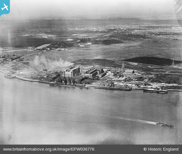
EPW036776 ENGLAND (1931). The Creekmouth Power Station and the River Thames, Creekmouth, from the south-east, 1931
© Copyright OpenStreetMap contributors and licensed by the OpenStreetMap Foundation. 2026. Cartography is licensed as CC BY-SA.
Nearby Images (7)
EPW036776

EPW010662

EPW010668

EPW010665

EPW008727

EPW009686

EPW010661

Details
| Title | [EPW036776] The Creekmouth Power Station and the River Thames, Creekmouth, from the south-east, 1931 |
| Reference | EPW036776 |
| Date | September-1931 |
| Link | |
| Place name | CREEKMOUTH |
| Parish | |
| District | |
| Country | ENGLAND |
| Easting / Northing | 546694, 181493 |
| Longitude / Latitude | 0.11426181370615, 51.512809832924 |
| National Grid Reference | TQ467815 |
Pins

stack1378 |
Thursday 17th of January 2019 11:05:35 PM | |
|
rac |
Thursday 13th of September 2018 09:05:39 PM | |
|
rac |
Thursday 13th of September 2018 09:04:43 PM | |
|
rac |
Thursday 13th of September 2018 09:03:43 PM | |
|
rac |
Thursday 13th of September 2018 09:01:50 PM | |
|
rac |
Thursday 13th of September 2018 09:00:56 PM | |
|
rac |
Thursday 13th of September 2018 09:00:14 PM | |
|
rac |
Thursday 13th of September 2018 08:59:19 PM |