
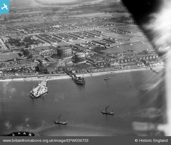
EPW036733 ENGLAND (1931). The Corporation Loading Pier, the Gasworks Pier and the Eastern Esplanade Gas Works, Southend-on-Sea, 1931. This image has been produced from a damaged negative.
© Copyright OpenStreetMap contributors and licensed by the OpenStreetMap Foundation. 2026. Cartography is licensed as CC BY-SA.
Nearby Images (5)
EPW036733

EPW036736

EPW036756

EPW040965

EAW002193

Details
| Title | [EPW036733] The Corporation Loading Pier, the Gasworks Pier and the Eastern Esplanade Gas Works, Southend-on-Sea, 1931. This image has been produced from a damaged negative. |
| Reference | EPW036733 |
| Date | September-1931 |
| Link | |
| Place name | SOUTHEND-ON-SEA |
| Parish | |
| District | |
| Country | ENGLAND |
| Easting / Northing | 589526, 184889 |
| Longitude / Latitude | 0.73274508306185, 51.530570766648 |
| National Grid Reference | TQ895849 |
Pins

Sara |
Thursday 18th of January 2024 07:47:37 PM | |
|
Sara |
Thursday 18th of January 2024 07:47:20 PM | |
|
Sara |
Thursday 18th of January 2024 07:46:40 PM | |
|
Sara |
Thursday 18th of January 2024 07:45:37 PM | |
|
Sara |
Thursday 18th of January 2024 07:45:11 PM | |
|
Sara |
Thursday 18th of January 2024 07:44:56 PM | |
|
bargee1937 |
Monday 1st of May 2017 04:51:45 AM |