
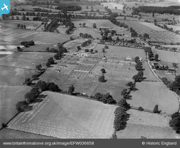
EPW036658 ENGLAND (1931). Farmland belonging to the Agricultural College (Harper Adams University College), Edgmond, from the south-east, 1931
© Copyright OpenStreetMap contributors and licensed by the OpenStreetMap Foundation. 2025. Cartography is licensed as CC BY-SA.
Nearby Images (8)
EPW036658
, Edgmond, from the south-east, 1931")
EPW017856
, Edgmond, from the south-east, 1927")
EPW036662
, Edgmond, 1931")
EPW036659
, Edgmond, from the south, 1931")
EPW036660
, Edgmond, from the south-west, 1931")
EPW017853
, Edgmond, from the south, 1927")
EPW017857
, Edgmond, from the south-east, 1927")
EPW017859
, Edgmond, from the south, 1927")
Details
| Title | [EPW036658] Farmland belonging to the Agricultural College (Harper Adams University College), Edgmond, from the south-east, 1931 |
| Reference | EPW036658 |
| Date | September-1931 |
| Link | |
| Place name | EDGMOND |
| Parish | EDGMOND |
| District | |
| Country | ENGLAND |
| Easting / Northing | 371572, 319587 |
| Longitude / Latitude | -2.42143345483, 52.772789586825 |
| National Grid Reference | SJ716196 |
Pins
Be the first to add a comment to this image!