
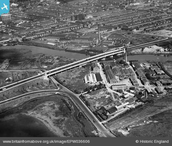
EPW036606 ENGLAND (1931). Alfred's Way (the A13) passing over Barking Creek, Barking, 1931
© Copyright OpenStreetMap contributors and licensed by the OpenStreetMap Foundation. 2026. Cartography is licensed as CC BY-SA.
Nearby Images (9)
EPW036606
 passing over Barking Creek, Barking, 1931")
EAW001440

EAW001435

EAW001436

EAW001437

EAW001439

EAW001438

EAW001433

EAW001434

Details
| Title | [EPW036606] Alfred's Way (the A13) passing over Barking Creek, Barking, 1931 |
| Reference | EPW036606 |
| Date | September-1931 |
| Link | |
| Place name | BARKING |
| Parish | |
| District | |
| Country | ENGLAND |
| Easting / Northing | 544442, 183018 |
| Longitude / Latitude | 0.082452766700867, 51.527094614677 |
| National Grid Reference | TQ444830 |
Pins
Be the first to add a comment to this image!