
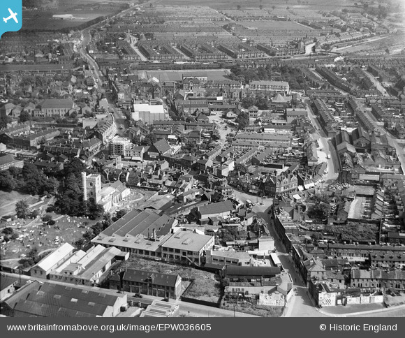
EPW036605 ENGLAND (1931). The town centre, Barking, 1931
© Copyright OpenStreetMap contributors and licensed by the OpenStreetMap Foundation. 2026. Cartography is licensed as CC BY-SA.
Nearby Images (3)
EPW036605

EPW036590

EPW036610

Details
| Title | [EPW036605] The town centre, Barking, 1931 |
| Reference | EPW036605 |
| Date | September-1931 |
| Link | |
| Place name | BARKING |
| Parish | |
| District | |
| Country | ENGLAND |
| Easting / Northing | 544167, 183900 |
| Longitude / Latitude | 0.07885197237228, 51.5350910245 |
| National Grid Reference | TQ442839 |
Pins

Hermann the German |
Tuesday 10th of October 2017 07:46:41 PM | |
|
Hermann the German |
Tuesday 10th of October 2017 07:45:07 PM | |
|
Hermann the German |
Wednesday 16th of August 2017 05:12:40 PM |