
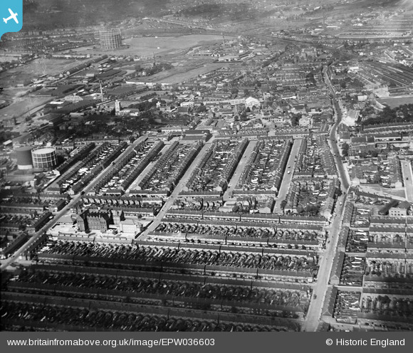
EPW036603 ENGLAND (1931). The town centre, Barking, from the south-east, 1931
© Copyright OpenStreetMap contributors and licensed by the OpenStreetMap Foundation. 2025. Cartography is licensed as CC BY-SA.
Nearby Images (2)
EPW036603

EPW036608

Details
| Title | [EPW036603] The town centre, Barking, from the south-east, 1931 |
| Reference | EPW036603 |
| Date | September-1931 |
| Link | |
| Place name | BARKING |
| Parish | |
| District | |
| Country | ENGLAND |
| Easting / Northing | 544589, 183563 |
| Longitude / Latitude | 0.084794371552073, 51.531954633993 |
| National Grid Reference | TQ446836 |
Pins
Be the first to add a comment to this image!