
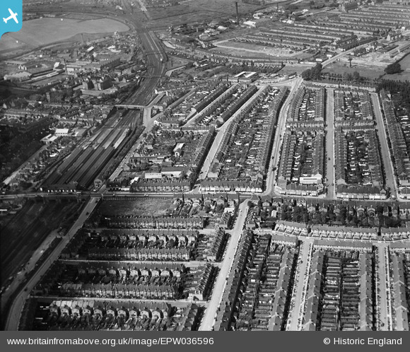
EPW036596 ENGLAND (1931). Glenny Road and environs, Barking, 1931
© Copyright OpenStreetMap contributors and licensed by the OpenStreetMap Foundation. 2026. Cartography is licensed as CC BY-SA.
Nearby Images (5)
EPW036596

EPW036477

EPW036591

EPW036594

EPW036475

Details
| Title | [EPW036596] Glenny Road and environs, Barking, 1931 |
| Reference | EPW036596 |
| Date | September-1931 |
| Link | |
| Place name | BARKING |
| Parish | |
| District | |
| Country | ENGLAND |
| Easting / Northing | 544471, 184491 |
| Longitude / Latitude | 0.083475047067315, 51.540324318794 |
| National Grid Reference | TQ445845 |
Pins

pl8man |
Wednesday 21st of August 2024 02:15:08 PM | |
|
pl8man |
Wednesday 21st of August 2024 02:14:11 PM | |
|
gerry |
Saturday 1st of September 2018 02:20:23 PM | |
|
arthur stevens |
Wednesday 30th of March 2016 07:22:35 PM | |
|
arthur stevens |
Wednesday 30th of March 2016 06:22:11 PM | |
|
arthur stevens |
Wednesday 30th of March 2016 06:20:20 PM | |
|
arthur stevens |
Wednesday 30th of March 2016 06:20:15 PM |