
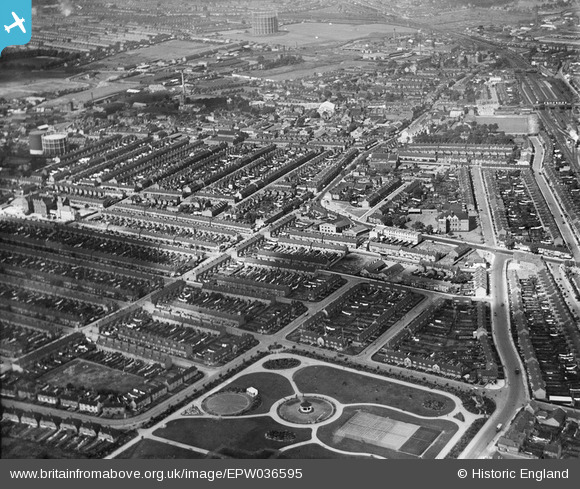
EPW036595 ENGLAND (1931). The town centre, Barking, from the south-east, 1931
© Copyright OpenStreetMap contributors and licensed by the OpenStreetMap Foundation. 2026. Cartography is licensed as CC BY-SA.
Nearby Images (3)
EPW036595

EPW036600

EPW036593

Details
| Title | [EPW036595] The town centre, Barking, from the south-east, 1931 |
| Reference | EPW036595 |
| Date | September-1931 |
| Link | |
| Place name | BARKING |
| Parish | |
| District | |
| Country | ENGLAND |
| Easting / Northing | 544928, 183554 |
| Longitude / Latitude | 0.089675133524499, 51.531786826069 |
| National Grid Reference | TQ449836 |
Pins

pl8man |
Friday 27th of December 2024 03:27:08 PM | |
|
JewlseyB |
Sunday 21st of June 2015 12:20:43 AM | |
|
JewlseyB |
Sunday 21st of June 2015 12:18:04 AM | |
|
JewlseyB |
Sunday 21st of June 2015 12:17:26 AM | |
|
JewlseyB |
Sunday 21st of June 2015 12:15:55 AM | |
|
JewlseyB |
Sunday 21st of June 2015 12:14:41 AM | |
|
PaulONeill |
Thursday 8th of January 2015 02:37:51 AM | |
|
mardell8 |
Friday 24th of January 2014 01:01:15 PM |