
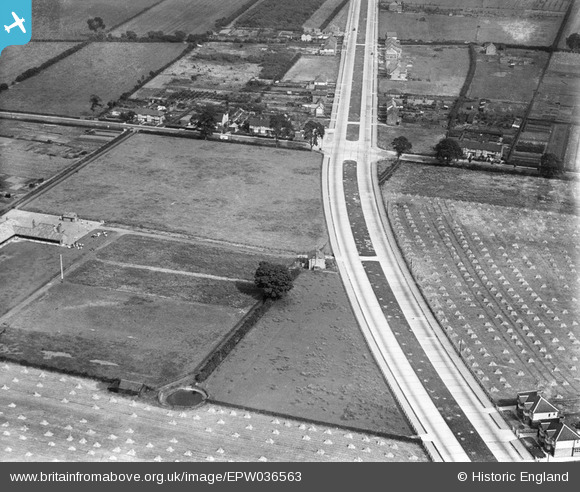
EPW036563 ENGLAND (1931). The junction of Boothferry Road and Beverley Road, Northfield, 1931
© Copyright OpenStreetMap contributors and licensed by the OpenStreetMap Foundation. 2025. Cartography is licensed as CC BY-SA.
Nearby Images (2)
EPW036563

EPW036564

Details
| Title | [EPW036563] The junction of Boothferry Road and Beverley Road, Northfield, 1931 |
| Reference | EPW036563 |
| Date | August-1931 |
| Link | |
| Place name | NORTHFIELD |
| Parish | HESSLE |
| District | |
| Country | ENGLAND |
| Easting / Northing | 503151, 427310 |
| Longitude / Latitude | -0.43619213849144, 53.731745989033 |
| National Grid Reference | TA032273 |
