
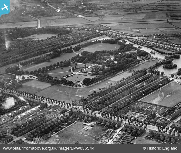
EPW036544 ENGLAND (1931). East Park, Kingston upon Hull, 1931
© Copyright OpenStreetMap contributors and licensed by the OpenStreetMap Foundation. 2025. Cartography is licensed as CC BY-SA.
Nearby Images (2)
EPW036544

EPW012701

Details
| Title | [EPW036544] East Park, Kingston upon Hull, 1931 |
| Reference | EPW036544 |
| Date | August-1931 |
| Link | |
| Place name | KINGSTON UPON HULL |
| Parish | |
| District | |
| Country | ENGLAND |
| Easting / Northing | 512070, 431071 |
| Longitude / Latitude | -0.29967536200946, 53.763698822625 |
| National Grid Reference | TA121311 |
Pins

Russell |
Tuesday 12th of May 2015 04:57:23 PM | |
|
Russell |
Tuesday 12th of May 2015 04:56:47 PM | |
|
John Wass |
Friday 28th of November 2014 11:43:46 AM | |
|
John Wass |
Friday 28th of November 2014 11:41:53 AM | |
|
John Wass |
Friday 28th of November 2014 11:37:59 AM |