
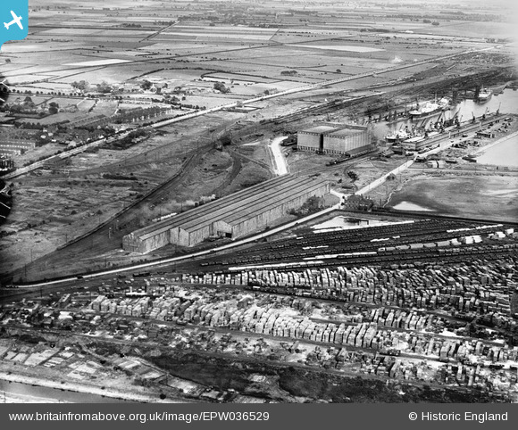
EPW036529 ENGLAND (1931). Timber yard at the west end of the King George Dock, Kingston upon Hull, 1931
© Copyright OpenStreetMap contributors and licensed by the OpenStreetMap Foundation. 2026. Cartography is licensed as CC BY-SA.
Nearby Images (5)
EPW036529

EPW036404

EPW055042

EAW015656

EAW015640

Details
| Title | [EPW036529] Timber yard at the west end of the King George Dock, Kingston upon Hull, 1931 |
| Reference | EPW036529 |
| Date | August-1931 |
| Link | |
| Place name | KINGSTON UPON HULL |
| Parish | |
| District | |
| Country | ENGLAND |
| Easting / Northing | 513479, 429053 |
| Longitude / Latitude | -0.279050106248, 53.745262025729 |
| National Grid Reference | TA135291 |
