
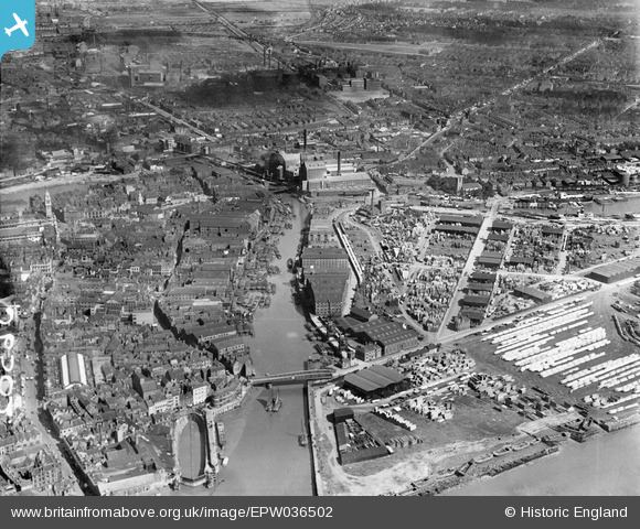
EPW036502 ENGLAND (1931). The River Hull and timber yards at Garrison Side, Kingston upon Hull, 1931
© Copyright OpenStreetMap contributors and licensed by the OpenStreetMap Foundation. 2026. Cartography is licensed as CC BY-SA.
Nearby Images (7)
EPW036502

EPW036507

EPW036382

EAW015658

EAW015645

EPW036528

EAW015638

Details
| Title | [EPW036502] The River Hull and timber yards at Garrison Side, Kingston upon Hull, 1931 |
| Reference | EPW036502 |
| Date | August-1931 |
| Link | |
| Place name | KINGSTON UPON HULL |
| Parish | |
| District | |
| Country | ENGLAND |
| Easting / Northing | 510313, 428653 |
| Longitude / Latitude | -0.32718357833951, 53.742347533981 |
| National Grid Reference | TA103287 |
Pins

CartoonHead |
Wednesday 23rd of September 2015 10:35:44 PM | |
|
John Wass |
Saturday 1st of August 2015 04:47:14 PM | |
|
John Wass |
Tuesday 26th of May 2015 08:44:55 PM | |
|
John Wass |
Tuesday 26th of May 2015 08:44:23 PM | |
|
CartoonHead |
Saturday 7th of March 2015 01:32:10 PM |