
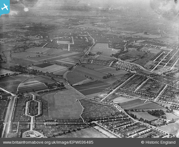
EPW036485 ENGLAND (1931). Goodmayes Lane and environs, Goodmayes, from the north-east, 1931
© Copyright OpenStreetMap contributors and licensed by the OpenStreetMap Foundation. 2025. Cartography is licensed as CC BY-SA.
Nearby Images (2)
EPW036485

EPW036480

Details
| Title | [EPW036485] Goodmayes Lane and environs, Goodmayes, from the north-east, 1931 |
| Reference | EPW036485 |
| Date | August-1931 |
| Link | |
| Place name | GOODMAYES |
| Parish | |
| District | |
| Country | ENGLAND |
| Easting / Northing | 546276, 186096 |
| Longitude / Latitude | 0.11015420722788, 51.554282425888 |
| National Grid Reference | TQ463861 |
Pins

Hermann the German |
Sunday 13th of August 2017 07:47:59 PM | |
|
Hermann the German |
Sunday 13th of August 2017 07:46:16 PM | |
|
Hermann the German |
Sunday 13th of August 2017 07:45:04 PM | |
|
Hermann the German |
Sunday 13th of August 2017 07:44:25 PM | |
|
Hermann the German |
Sunday 13th of August 2017 07:43:47 PM | |
|
Hermann the German |
Sunday 13th of August 2017 07:41:41 PM | |
|
Hermann the German |
Sunday 13th of August 2017 07:40:11 PM | |
|
Hermann the German |
Sunday 13th of August 2017 07:38:39 PM | |
|
Hermann the German |
Sunday 13th of August 2017 07:37:23 PM | |
|
Hermann the German |
Wednesday 2nd of July 2014 07:27:27 PM | |
|
Hermann the German |
Wednesday 2nd of July 2014 07:23:19 PM | |
|
windblown |
Friday 15th of February 2013 10:42:23 PM |
User Comment Contributions
I guess that would be the southern end of Goodmayes Park at the bottom of the photo. |
windblown |
Friday 15th of February 2013 10:41:37 PM |