
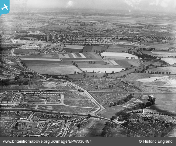
EPW036484 ENGLAND (1931). The site of the Leftley Estate and environs, Barking, from the south, 1931
© Copyright OpenStreetMap contributors and licensed by the OpenStreetMap Foundation. 2025. Cartography is licensed as CC BY-SA.
Nearby Images (3)
EPW036484

EPW036483

EPW036488

Details
| Title | [EPW036484] The site of the Leftley Estate and environs, Barking, from the south, 1931 |
| Reference | EPW036484 |
| Date | August-1931 |
| Link | |
| Place name | BARKING |
| Parish | |
| District | |
| Country | ENGLAND |
| Easting / Northing | 545897, 184206 |
| Longitude / Latitude | 0.10390698180243, 51.537396349941 |
| National Grid Reference | TQ459842 |
Pins

JewlseyB |
Wednesday 5th of April 2017 07:14:19 PM | |
|
JewlseyB |
Wednesday 5th of April 2017 07:08:49 PM | |
|
JewlseyB |
Wednesday 5th of April 2017 06:58:48 PM | |
|
JewlseyB |
Wednesday 5th of April 2017 06:53:45 PM | |
|
JewlseyB |
Wednesday 5th of April 2017 06:50:59 PM | |
|
JewlseyB |
Wednesday 5th of April 2017 06:50:06 PM | |
|
JewlseyB |
Wednesday 5th of April 2017 06:49:05 PM | |
|
JewlseyB |
Wednesday 5th of April 2017 06:48:14 PM | |
|
JewlseyB |
Wednesday 5th of April 2017 06:44:19 PM | |
|
JewlseyB |
Wednesday 5th of April 2017 06:43:09 PM | |
|
JewlseyB |
Wednesday 5th of April 2017 06:42:07 PM | |
|
JewlseyB |
Wednesday 5th of April 2017 06:41:06 PM | |
|
JewlseyB |
Wednesday 5th of April 2017 06:39:40 PM | |
|
Chelsea61 |
Wednesday 3rd of July 2013 11:29:43 PM | |
|
Chelsea61 |
Wednesday 3rd of July 2013 11:29:18 PM | |
|
Chelsea61 |
Wednesday 3rd of July 2013 11:29:01 PM | |
|
Chelsea61 |
Wednesday 3rd of July 2013 11:28:44 PM | |
|
Chelsea61 |
Wednesday 3rd of July 2013 11:28:26 PM |