
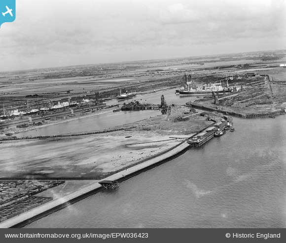
EPW036423 ENGLAND (1931). The King George Dock and environs, Kingston upon Hull, from the west, 1931
© Copyright OpenStreetMap contributors and licensed by the OpenStreetMap Foundation. 2026. Cartography is licensed as CC BY-SA.
Nearby Images (5)
EPW036423

EAW004511

EPW036421

EAW693178

EPW036424

Details
| Title | [EPW036423] The King George Dock and environs, Kingston upon Hull, from the west, 1931 |
| Reference | EPW036423 |
| Date | August-1931 |
| Link | |
| Place name | KINGSTON UPON HULL |
| Parish | |
| District | |
| Country | ENGLAND |
| Easting / Northing | 513617, 428562 |
| Longitude / Latitude | -0.27713884217885, 53.740820316931 |
| National Grid Reference | TA136286 |
Pins
Be the first to add a comment to this image!