
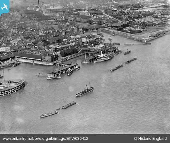
EPW036412 ENGLAND (1931). The Humber Dock Basin, Victoria Pier and the Old Harbour entrance, Kingston upon Hull, 1931
© Copyright OpenStreetMap contributors and licensed by the OpenStreetMap Foundation. 2026. Cartography is licensed as CC BY-SA.
Nearby Images (9)
EPW036412

EAW004514

EPW036413

EPW036414

EAW046145

EPW036560

EAW046146

EPW036375

EPW012696

Details
| Title | [EPW036412] The Humber Dock Basin, Victoria Pier and the Old Harbour entrance, Kingston upon Hull, 1931 |
| Reference | EPW036412 |
| Date | August-1931 |
| Link | |
| Place name | KINGSTON UPON HULL |
| Parish | |
| District | |
| Country | ENGLAND |
| Easting / Northing | 509950, 428066 |
| Longitude / Latitude | -0.33289444400833, 53.737149851447 |
| National Grid Reference | TA100281 |
Pins

ken |
Wednesday 14th of October 2015 03:59:23 PM | |
|
Melm |
Wednesday 23rd of January 2013 10:50:42 AM | |
A more correct name would be "New Holland Ferry" from the Hull end. |
John Wass |
Saturday 12th of July 2014 02:30:54 PM |
Depends where you are! Hull Ferry if you are in Licncolnshire. |
Bartonian |
Thursday 6th of November 2014 01:08:57 AM |