
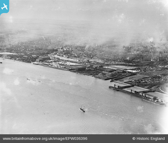
EPW036396 ENGLAND (1931). The West Wharf, Earle's Shipbuilding and Engineering Yard and Victoria Dock, Kingston upon Hull, from the south-east, 1931
© Copyright OpenStreetMap contributors and licensed by the OpenStreetMap Foundation. 2026. Cartography is licensed as CC BY-SA.
Nearby Images (5)
EPW036396

EPW036407

EPW010812

EPW036386

EAW004506

Details
| Title | [EPW036396] The West Wharf, Earle's Shipbuilding and Engineering Yard and Victoria Dock, Kingston upon Hull, from the south-east, 1931 |
| Reference | EPW036396 |
| Date | August-1931 |
| Link | |
| Place name | KINGSTON UPON HULL |
| Parish | |
| District | |
| Country | ENGLAND |
| Easting / Northing | 511819, 428375 |
| Longitude / Latitude | -0.30445769187044, 53.739528819591 |
| National Grid Reference | TA118284 |
Pins
Be the first to add a comment to this image!