
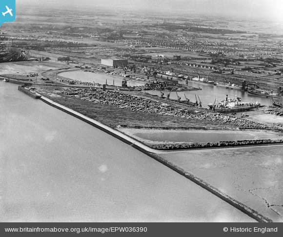
EPW036390 ENGLAND (1931). The King George Dock and environs, Kingston upon Hull, 1931
© Copyright OpenStreetMap contributors and licensed by the OpenStreetMap Foundation. 2026. Cartography is licensed as CC BY-SA.
Nearby Images (3)
EPW036390

EPW036383

EPW036511

Details
| Title | [EPW036390] The King George Dock and environs, Kingston upon Hull, 1931 |
| Reference | EPW036390 |
| Date | August-1931 |
| Link | |
| Place name | KINGSTON UPON HULL |
| Parish | |
| District | |
| Country | ENGLAND |
| Easting / Northing | 514376, 428476 |
| Longitude / Latitude | -0.26566715446911, 53.739881653759 |
| National Grid Reference | TA144285 |
Pins
Be the first to add a comment to this image!