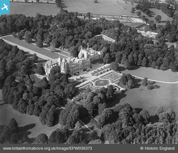
EPW036373 ENGLAND (1931). Waddesdon Manor, Waddesdon, 1931
© Copyright OpenStreetMap contributors and licensed by the OpenStreetMap Foundation. 2025. Cartography is licensed as CC BY-SA.
Nearby Images (6)
Details
| Title | [EPW036373] Waddesdon Manor, Waddesdon, 1931 |
| Reference | EPW036373 |
| Date | August-1931 |
| Link | |
| Place name | WADDESDON |
| Parish | WADDESDON |
| District | |
| Country | ENGLAND |
| Easting / Northing | 473313, 216490 |
| Longitude / Latitude | -0.93571587889895, 51.841750803626 |
| National Grid Reference | SP733165 |
Pins
Be the first to add a comment to this image!


![[EPW036373] Waddesdon Manor, Waddesdon, 1931](http://britainfromabove.org.uk/sites/all/libraries/aerofilms-images/public/100x100/EPW/036/EPW036373.jpg)
![[EAW047976] Waddesdon Manor in the snow, Waddesdon, from the south-east, 1952](http://britainfromabove.org.uk/sites/all/libraries/aerofilms-images/public/100x100/EAW/047/EAW047976.jpg)
![[EPW036374] Waddesdon Manor, Waddesdon, 1931](http://britainfromabove.org.uk/sites/all/libraries/aerofilms-images/public/100x100/EPW/036/EPW036374.jpg)
![[EAW047975] Waddesdon Manor in the snow, Waddesdon, 1952](http://britainfromabove.org.uk/sites/all/libraries/aerofilms-images/public/100x100/EAW/047/EAW047975.jpg)
![[EAW047977] Waddesdon Manor in the snow, Waddesdon, from the south, 1952](http://britainfromabove.org.uk/sites/all/libraries/aerofilms-images/public/100x100/EAW/047/EAW047977.jpg)
![[EPW036372] Waddesdon Manor, Waddesdon, 1931](http://britainfromabove.org.uk/sites/all/libraries/aerofilms-images/public/100x100/EPW/036/EPW036372.jpg)
