
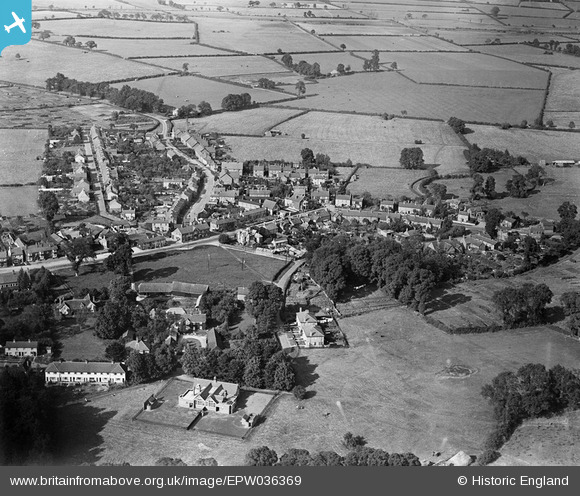
EPW036369 ENGLAND (1931). The village centre, Waddesdon, 1931
© Copyright OpenStreetMap contributors and licensed by the OpenStreetMap Foundation. 2025. Cartography is licensed as CC BY-SA.
Nearby Images (2)
EPW036369

EPW036368

Details
| Title | [EPW036369] The village centre, Waddesdon, 1931 |
| Reference | EPW036369 |
| Date | August-1931 |
| Link | |
| Place name | WADDESDON |
| Parish | WADDESDON |
| District | |
| Country | ENGLAND |
| Easting / Northing | 474438, 216921 |
| Longitude / Latitude | -0.91929458489017, 51.845476779754 |
| National Grid Reference | SP744169 |
Pins
Be the first to add a comment to this image!