
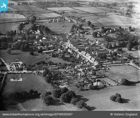
EPW036367 ENGLAND (1931). The High Street and environs, Princes Risborough, 1931
© Copyright OpenStreetMap contributors and licensed by the OpenStreetMap Foundation. 2025. Cartography is licensed as CC BY-SA.
Nearby Images (3)
EPW036367

EPW036366

EPW036363

Details
| Title | [EPW036367] The High Street and environs, Princes Risborough, 1931 |
| Reference | EPW036367 |
| Date | August-1931 |
| Link | |
| Place name | PRINCES RISBOROUGH |
| Parish | PRINCES RISBOROUGH |
| District | |
| Country | ENGLAND |
| Easting / Northing | 480821, 203368 |
| Longitude / Latitude | -0.82980217655202, 51.722745019879 |
| National Grid Reference | SP808034 |
Pins
Be the first to add a comment to this image!