
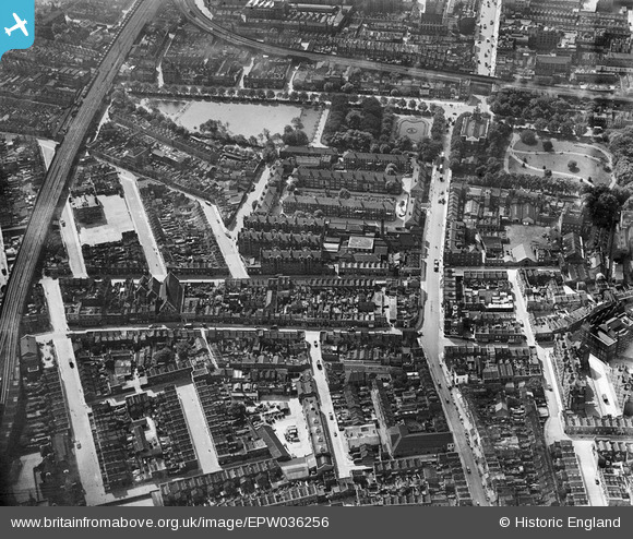
EPW036256 ENGLAND (1931). Bethnal Green Gardens and the Bethnal Green Estate, Bethnal Green, 1931
© Copyright OpenStreetMap contributors and licensed by the OpenStreetMap Foundation. 2026. Cartography is licensed as CC BY-SA.
Nearby Images (7)
EPW036256

EPW036257

EPW036255

EPW036260

EPW036261

EPW036258

EPW036259

Details
| Title | [EPW036256] Bethnal Green Gardens and the Bethnal Green Estate, Bethnal Green, 1931 |
| Reference | EPW036256 |
| Date | August-1931 |
| Link | |
| Place name | BETHNAL GREEN |
| Parish | |
| District | |
| Country | ENGLAND |
| Easting / Northing | 535247, 182701 |
| Longitude / Latitude | -0.050149952050085, 51.526523213674 |
| National Grid Reference | TQ352827 |
Pins

ray 7 |
Wednesday 20th of May 2020 12:26:37 PM | |
|
ray 7 |
Tuesday 19th of May 2020 08:47:36 PM | |
|
ray 7 |
Tuesday 19th of May 2020 08:42:03 PM | |
|
ray 7 |
Tuesday 19th of May 2020 08:36:07 PM | |
|
ray 7 |
Tuesday 19th of May 2020 08:34:12 PM | |
|
ray 7 |
Tuesday 19th of May 2020 08:27:58 PM | |
|
ray 7 |
Tuesday 19th of May 2020 08:13:21 PM | |
|
ray 7 |
Tuesday 19th of May 2020 08:12:36 PM | |
|
Charles |
Friday 4th of December 2015 01:12:11 PM | |
The Salmon and Ball pub is still going strong. Not the most fashionable of watering holes but doing a trade. |
Charles |
Wednesday 27th of April 2016 03:46:43 PM |
|
TinyTim |
Thursday 30th of July 2015 05:06:20 PM | |

hillman34 |
Thursday 20th of June 2013 08:52:52 PM | |
|
ken |
Wednesday 13th of March 2013 09:11:09 PM | |
|
ken |
Friday 8th of March 2013 06:14:01 PM | |
|
ken |
Friday 8th of March 2013 06:12:49 PM | |
|
ken |
Friday 8th of March 2013 06:00:30 PM | |
|
Trebor |
Sunday 16th of December 2012 05:37:06 AM | |
|
Trebor |
Sunday 16th of December 2012 05:36:10 AM | |
|
Trebor |
Sunday 16th of December 2012 05:35:19 AM |


