
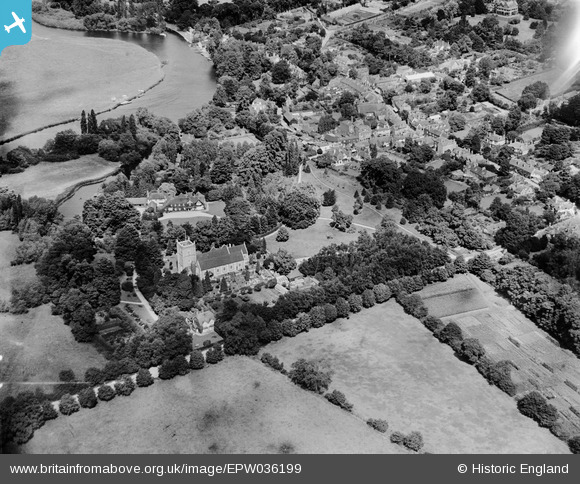
EPW036199 ENGLAND (1931). St Mary's Church and environs, Wargrave, 1931
© Copyright OpenStreetMap contributors and licensed by the OpenStreetMap Foundation. 2025. Cartography is licensed as CC BY-SA.
Nearby Images (2)
EPW036199

EPW036200

Details
| Title | [EPW036199] St Mary's Church and environs, Wargrave, 1931 |
| Reference | EPW036199 |
| Date | August-1931 |
| Link | |
| Place name | WARGRAVE |
| Parish | WARGRAVE |
| District | |
| Country | ENGLAND |
| Easting / Northing | 478349, 178490 |
| Longitude / Latitude | -0.87114849396154, 51.499428277938 |
| National Grid Reference | SU783785 |
Pins
Be the first to add a comment to this image!