
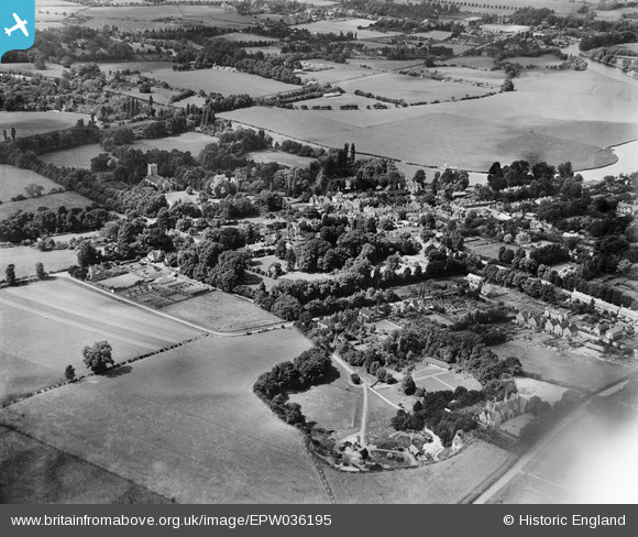
EPW036195 ENGLAND (1931). The town, Wargrave, from the south-east, 1931
© Copyright OpenStreetMap contributors and licensed by the OpenStreetMap Foundation. 2025. Cartography is licensed as CC BY-SA.
Nearby Images (3)
EPW036195

EPW036198

EPW036196

Details
| Title | [EPW036195] The town, Wargrave, from the south-east, 1931 |
| Reference | EPW036195 |
| Date | August-1931 |
| Link | |
| Place name | WARGRAVE |
| Parish | WARGRAVE |
| District | |
| Country | ENGLAND |
| Easting / Northing | 478795, 178267 |
| Longitude / Latitude | -0.86477369982213, 51.497361330209 |
| National Grid Reference | SU788783 |
Pins
Be the first to add a comment to this image!