
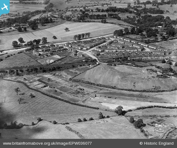
EPW036077 ENGLAND (1931). Killingbeck Colliery, Sutton Approach and environs, Killingbeck, 1931
© Copyright OpenStreetMap contributors and licensed by the OpenStreetMap Foundation. 2026. Cartography is licensed as CC BY-SA.
Nearby Images (11)
EPW036077

EPW036075

EPW036072

EPW036073

EPW036071

EPW036076

EPW036074

EPW036068

EPW036070

EPW036067

EPW036069

Details
| Title | [EPW036077] Killingbeck Colliery, Sutton Approach and environs, Killingbeck, 1931 |
| Reference | EPW036077 |
| Date | 18-July-1931 |
| Link | |
| Place name | KILLINGBECK |
| Parish | |
| District | |
| Country | ENGLAND |
| Easting / Northing | 434507, 434109 |
| Longitude / Latitude | -1.4760051362312, 53.801921206896 |
| National Grid Reference | SE345341 |
Pins
Be the first to add a comment to this image!