
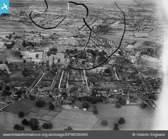
EPW036060 ENGLAND (1931). The town and surrounding countryside, Belper, 1931. This image has been produced from a damaged negative.
© Copyright OpenStreetMap contributors and licensed by the OpenStreetMap Foundation. 2026. Cartography is licensed as CC BY-SA.
Nearby Images (3)
EPW036060

EPW021105

EPW021108

Details
| Title | [EPW036060] The town and surrounding countryside, Belper, 1931. This image has been produced from a damaged negative. |
| Reference | EPW036060 |
| Date | July-1931 |
| Link | |
| Place name | BELPER |
| Parish | BELPER |
| District | |
| Country | ENGLAND |
| Easting / Northing | 434959, 347726 |
| Longitude / Latitude | -1.4787241793834, 53.025375829475 |
| National Grid Reference | SK350477 |
Pins

lather30 |
Saturday 12th of July 2014 04:55:00 PM | |
|
lather30 |
Saturday 12th of July 2014 04:52:56 PM | |
|
lather30 |
Saturday 12th of July 2014 04:50:13 PM | |
|
lather30 |
Saturday 12th of July 2014 04:48:39 PM | |
|
lather30 |
Saturday 12th of July 2014 04:46:21 PM | |
|
tomfoulk |
Friday 3rd of May 2013 01:22:44 PM | |
|
tomfoulk |
Friday 3rd of May 2013 01:21:48 PM | |
|
tomfoulk |
Friday 3rd of May 2013 01:20:02 PM |