
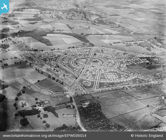
EPW036014 ENGLAND (1931). The Aspley Housing Estate, Aspley, 1931
© Copyright OpenStreetMap contributors and licensed by the OpenStreetMap Foundation. 2026. Cartography is licensed as CC BY-SA.
Nearby Images (14)
EPW036014

EPW038651

EPW038659

EPW036013

EPW038653

EPW036016

EPW038650

EPW038654

EPW036012

EPW038657

EPW038656

EPW038658

EPW038652

EPW038655

Details
| Title | [EPW036014] The Aspley Housing Estate, Aspley, 1931 |
| Reference | EPW036014 |
| Date | July-1931 |
| Link | |
| Place name | ASPLEY |
| Parish | |
| District | |
| Country | ENGLAND |
| Easting / Northing | 453627, 342287 |
| Longitude / Latitude | -1.2012917697727, 52.974937325253 |
| National Grid Reference | SK536423 |
Pins

Dave |
Saturday 2nd of August 2025 03:40:54 PM | |
|
Dave |
Saturday 2nd of August 2025 03:40:00 PM | |
|
AnnieH |
Sunday 18th of October 2020 09:32:37 AM | |
|
Rich 2020 |
Tuesday 29th of July 2014 12:12:39 PM | |
|
Rich 2020 |
Tuesday 29th of July 2014 12:03:15 PM | |
|
Rich 2020 |
Tuesday 29th of July 2014 11:53:37 AM |