
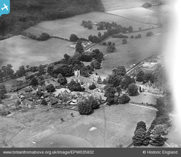
EPW035832 ENGLAND (1931). St Mary's Church and the village, Hambleden, 1931
© Copyright OpenStreetMap contributors and licensed by the OpenStreetMap Foundation. 2026. Cartography is licensed as CC BY-SA.
Nearby Images (4)
EPW035832

EPW052536

EPW035833

EPW035834

Details
| Title | [EPW035832] St Mary's Church and the village, Hambleden, 1931 |
| Reference | EPW035832 |
| Date | July-1931 |
| Link | |
| Place name | HAMBLEDEN |
| Parish | HAMBLEDEN |
| District | |
| Country | ENGLAND |
| Easting / Northing | 478363, 186648 |
| Longitude / Latitude | -0.86913045405041, 51.572772476713 |
| National Grid Reference | SU784866 |
Pins
Robert Tims |
Tuesday 4th of March 2014 12:53:39 PM |