
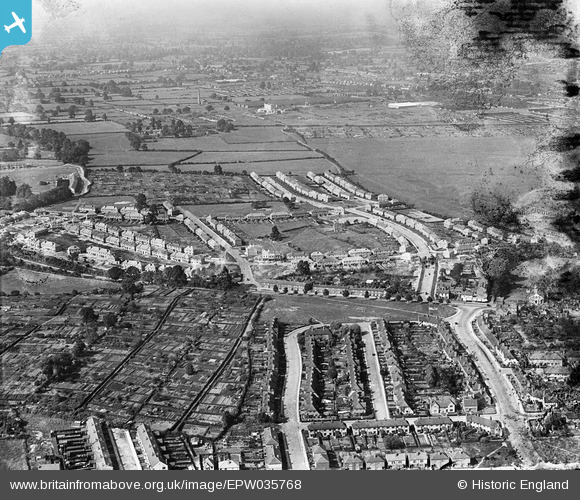
EPW035768 ENGLAND (1931). Radford Common and housing surrounding Radford Road, Holland Road and Beake Avenue, Radford, from the south-west, 1931
© Copyright OpenStreetMap contributors and licensed by the OpenStreetMap Foundation. 2026. Cartography is licensed as CC BY-SA.
Details
| Title | [EPW035768] Radford Common and housing surrounding Radford Road, Holland Road and Beake Avenue, Radford, from the south-west, 1931 |
| Reference | EPW035768 |
| Date | 1-July-1931 |
| Link | |
| Place name | RADFORD |
| Parish | |
| District | |
| Country | ENGLAND |
| Easting / Northing | 432352, 280742 |
| Longitude / Latitude | -1.5241957700215, 52.423332142584 |
| National Grid Reference | SP324807 |
Pins

Denise |
Tuesday 16th of August 2022 08:01:08 AM | |
|
Shaky |
Tuesday 27th of January 2015 09:08:36 PM | |

offshoredaze |
Sunday 19th of January 2014 10:08:05 PM | |
|
offshoredaze |
Sunday 19th of January 2014 10:05:19 PM | |
|
offshoredaze |
Sunday 19th of January 2014 10:04:32 PM | |
|
offshoredaze |
Tuesday 17th of December 2013 10:01:05 PM | |
|
offshoredaze |
Tuesday 17th of December 2013 09:59:53 PM | |
|
offshoredaze |
Tuesday 17th of December 2013 09:58:37 PM | |
|
offshoredaze |
Tuesday 17th of December 2013 09:56:32 PM | |
|
offshoredaze |
Tuesday 17th of December 2013 09:55:46 PM | |
|
offshoredaze |
Tuesday 17th of December 2013 09:54:27 PM | |
|
offshoredaze |
Tuesday 17th of December 2013 09:53:48 PM | |
|
offshoredaze |
Tuesday 17th of December 2013 09:52:34 PM | |
|
offshoredaze |
Tuesday 17th of December 2013 09:50:08 PM |
User Comment Contributions

Another example of the rapid expansion of the area |
offshoredaze |
Sunday 15th of December 2013 07:35:04 PM |