
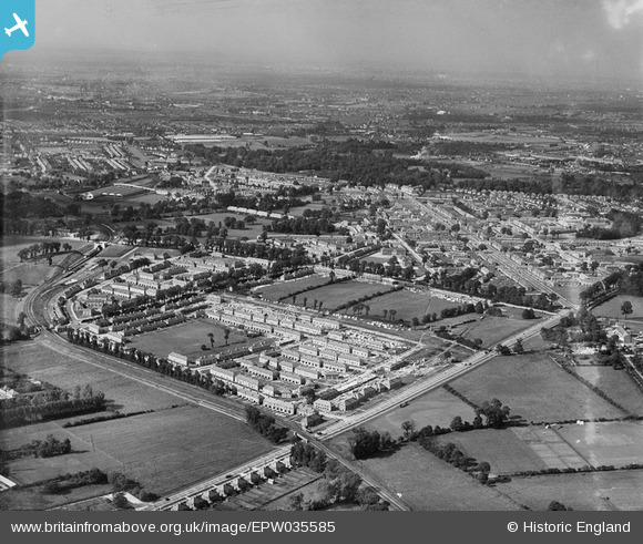
EPW035585 ENGLAND (1931). Housing surrounding Reigate Avenue, St Helier Avenue and environs, Rosehill, from the south, 1931
© Copyright OpenStreetMap contributors and licensed by the OpenStreetMap Foundation. 2026. Cartography is licensed as CC BY-SA.
Nearby Images (2)
EPW035585

EPW035586

Details
| Title | [EPW035585] Housing surrounding Reigate Avenue, St Helier Avenue and environs, Rosehill, from the south, 1931 |
| Reference | EPW035585 |
| Date | June-1931 |
| Link | |
| Place name | ROSEHILL |
| Parish | |
| District | |
| Country | ENGLAND |
| Easting / Northing | 525665, 166491 |
| Longitude / Latitude | -0.19397666070081, 51.383040364383 |
| National Grid Reference | TQ257665 |
Pins

tags66 |
Tuesday 4th of July 2017 03:09:28 PM | |
|
John Wass |
Tuesday 19th of May 2015 09:30:31 PM | |
|
christhewino |
Wednesday 12th of December 2012 03:22:19 PM | |
|
christhewino |
Wednesday 12th of December 2012 03:22:01 PM | |
|
christhewino |
Wednesday 12th of December 2012 03:21:36 PM | |
|
christhewino |
Wednesday 12th of December 2012 03:17:44 PM |