
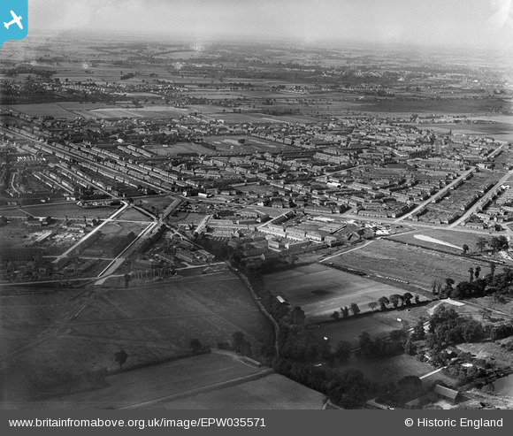
EPW035571 ENGLAND (1931). New housing at Becontree, Dagenham, from the south-west, 1931
© Copyright OpenStreetMap contributors and licensed by the OpenStreetMap Foundation. 2025. Cartography is licensed as CC BY-SA.
Nearby Images (2)
EPW035571

EAW048076

Details
| Title | [EPW035571] New housing at Becontree, Dagenham, from the south-west, 1931 |
| Reference | EPW035571 |
| Date | June-1931 |
| Link | |
| Place name | DAGENHAM |
| Parish | |
| District | |
| Country | ENGLAND |
| Easting / Northing | 547642, 185146 |
| Longitude / Latitude | 0.12944654657892, 51.545389636086 |
| National Grid Reference | TQ476851 |
Pins

Mags |
Thursday 27th of February 2020 04:44:16 PM | |
|
mardell8 |
Friday 4th of October 2013 07:20:43 PM | |
|
Chelsea61 |
Saturday 22nd of June 2013 12:27:11 PM | |
|
Chelsea61 |
Friday 21st of June 2013 06:19:47 PM | |
|
Chelsea61 |
Friday 21st of June 2013 06:19:26 PM | |
|
Chelsea61 |
Friday 21st of June 2013 06:19:03 PM | |
|
Chelsea61 |
Friday 21st of June 2013 06:18:15 PM | |
|
steve _b |
Monday 14th of January 2013 05:23:09 PM |
User Comment Contributions

Google Image of same road junction |
Chelsea61 |
Friday 21st of June 2013 06:23:26 PM |