
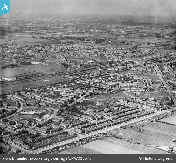
EPW035570 ENGLAND (1931). Goresbrook Park and housing off Goresbrook Road, Dagenham, from the south-west, 1931
© Copyright OpenStreetMap contributors and licensed by the OpenStreetMap Foundation. 2026. Cartography is licensed as CC BY-SA.
Nearby Images (2)
EPW035570

EPW035569

Details
| Title | [EPW035570] Goresbrook Park and housing off Goresbrook Road, Dagenham, from the south-west, 1931 |
| Reference | EPW035570 |
| Date | June-1931 |
| Link | |
| Place name | DAGENHAM |
| Parish | |
| District | |
| Country | ENGLAND |
| Easting / Northing | 548023, 184068 |
| Longitude / Latitude | 0.13448419521176, 51.535602693234 |
| National Grid Reference | TQ480841 |
Pins

Lixida |
Sunday 24th of August 2014 11:06:23 PM | |
|
Chelsea61 |
Saturday 22nd of June 2013 11:49:58 AM | |
|
Chelsea61 |
Saturday 22nd of June 2013 11:48:41 AM | |
|
Chelsea61 |
Saturday 22nd of June 2013 11:47:27 AM | |
|
Chelsea61 |
Saturday 22nd of June 2013 11:45:56 AM | |
|
Chelsea61 |
Saturday 22nd of June 2013 11:42:56 AM |