
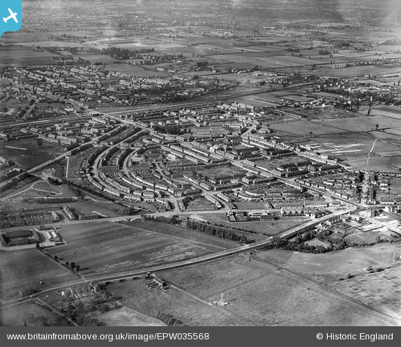
EPW035568 ENGLAND (1931). Housing estate off Heathway and Goresbrook Road, Dagenham, 1931
© Copyright OpenStreetMap contributors and licensed by the OpenStreetMap Foundation. 2026. Cartography is licensed as CC BY-SA.
Nearby Images (2)
EPW035568

EPW010921

Details
| Title | [EPW035568] Housing estate off Heathway and Goresbrook Road, Dagenham, 1931 |
| Reference | EPW035568 |
| Date | June-1931 |
| Link | |
| Place name | DAGENHAM |
| Parish | |
| District | |
| Country | ENGLAND |
| Easting / Northing | 548998, 184036 |
| Longitude / Latitude | 0.14851950051099, 51.53505860776 |
| National Grid Reference | TQ490840 |
Pins

Ken Stanton |
Sunday 9th of May 2021 04:19:16 PM | |
|
Ken Stanton |
Sunday 9th of May 2021 04:17:44 PM | |
|
Ken Stanton |
Sunday 9th of May 2021 04:16:43 PM | |
|
Ken Stanton |
Sunday 9th of May 2021 04:14:23 PM | |
|
Ken Stanton |
Sunday 9th of May 2021 04:12:40 PM | |
|
Ken Stanton |
Sunday 9th of May 2021 04:11:19 PM | |
|
Ken Stanton |
Sunday 9th of May 2021 04:05:05 PM | |
|
Ken Stanton |
Sunday 9th of May 2021 04:03:57 PM | |
|
Ken Stanton |
Sunday 9th of May 2021 04:02:18 PM |