
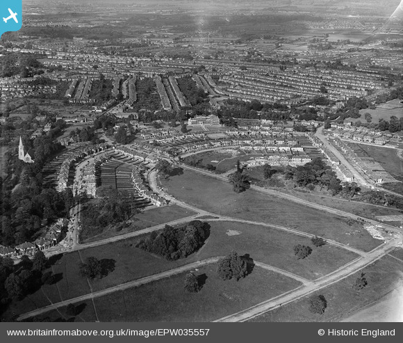
EPW035557 ENGLAND (1931). Housing at Arnos Grove, Christ Church and environs, New Southgate, 1931
© Copyright OpenStreetMap contributors and licensed by the OpenStreetMap Foundation. 2026. Cartography is licensed as CC BY-SA.
Nearby Images (2)
EPW035557

EPW035556

Details
| Title | [EPW035557] Housing at Arnos Grove, Christ Church and environs, New Southgate, 1931 |
| Reference | EPW035557 |
| Date | June-1931 |
| Link | |
| Place name | NEW SOUTHGATE |
| Parish | |
| District | |
| Country | ENGLAND |
| Easting / Northing | 529763, 193179 |
| Longitude / Latitude | -0.12529478511672, 51.621982160925 |
| National Grid Reference | TQ298932 |
Pins

BrightonDJ |
Sunday 2nd of February 2025 05:35:04 PM | |

downloader141 |
Thursday 21st of July 2016 05:54:53 PM | |
|
downloader141 |
Thursday 21st of July 2016 05:45:49 PM | |
|
downloader141 |
Thursday 21st of July 2016 05:41:23 PM | |
|
downloader141 |
Sunday 3rd of April 2016 11:16:01 AM | |
|
ChrisL |
Monday 16th of December 2013 11:36:02 PM | |
|
ChrisL |
Monday 16th of December 2013 11:31:58 PM | |

Class31 |
Wednesday 27th of March 2013 09:03:52 PM | |
|
Class31 |
Wednesday 27th of March 2013 09:02:28 PM | |
|
Class31 |
Wednesday 27th of March 2013 08:58:49 PM |
