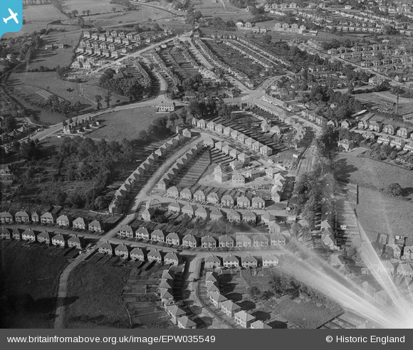
EPW035549 ENGLAND (1931). Housing at Orchard Crescent, Grange Close and environs, Mill Hill, 1931
    © Copyright OpenStreetMap contributors and licensed by the OpenStreetMap Foundation. 2025. Cartography is licensed as CC BY-SA.
  
Nearby Images (7)
Details
| Title | [EPW035549] Housing at Orchard Crescent, Grange Close and environs, Mill Hill, 1931 | 
| Reference | EPW035549 | 
| Date | July-1931 | 
| Link | |
| Place name | MILL HILL | 
| Parish | |
| District | |
| Country | ENGLAND | 
| Easting / Northing | 520334, 192190 | 
| Longitude / Latitude | -0.26178650591368, 51.615188393883 | 
| National Grid Reference | TQ203922 | 
 
             
  ![[EPW035549] Housing at Orchard Crescent, Grange Close and environs, Mill Hill, 1931](http://britainfromabove.org.uk/sites/all/libraries/aerofilms-images/public/100x100/EPW/035/EPW035549.jpg) 
  
                                          ![[EPW034563] New housing at Orchard Crescent, Edgware, 1930](http://britainfromabove.org.uk/sites/all/libraries/aerofilms-images/public/100x100/EPW/034/EPW034563.jpg) 
 ![[EPW035552] Housing surrounding Orchard Crescent, the Rawplug Co Ltd Works and environs, Mill Hill, 1931](http://britainfromabove.org.uk/sites/all/libraries/aerofilms-images/public/100x100/EPW/035/EPW035552.jpg) 
 ![[EPW034559] New housing at Orchard Crescent, Edgware, from the north-east, 1930](http://britainfromabove.org.uk/sites/all/libraries/aerofilms-images/public/100x100/EPW/034/EPW034559.jpg) 
 ![[EPW034565] New housing at Orchard Crescent, Edgware, 1930](http://britainfromabove.org.uk/sites/all/libraries/aerofilms-images/public/100x100/EPW/034/EPW034565.jpg) 
 ![[EAW033375] Burnt Oak, Edgware and environs, Burnt Oak, 1950](http://britainfromabove.org.uk/sites/all/libraries/aerofilms-images/public/100x100/EAW/033/EAW033375.jpg) 
 ![[EPW034566] New housing at Oakwood Drive, Edgware, 1930](http://britainfromabove.org.uk/sites/all/libraries/aerofilms-images/public/100x100/EPW/034/EPW034566.jpg) 
  The A1.
 The A1.