
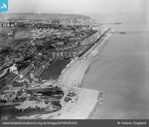
EPW035343 ENGLAND (1931). West Marina and the town, St Leonards, from the west, 1931
© Copyright OpenStreetMap contributors and licensed by the OpenStreetMap Foundation. 2026. Cartography is licensed as CC BY-SA.
Nearby Images (11)
EPW035343

EPW016893

EAW002427

EAW002426

EPW026203

EPW042843

EPW026197

EAW002428

EPW042842

EAW002425

EPW042835

Details
| Title | [EPW035343] West Marina and the town, St Leonards, from the west, 1931 |
| Reference | EPW035343 |
| Date | 25-May-1931 |
| Link | |
| Place name | ST LEONARDS |
| Parish | |
| District | |
| Country | ENGLAND |
| Easting / Northing | 578520, 108693 |
| Longitude / Latitude | 0.53634307830419, 50.849611024378 |
| National Grid Reference | TQ785087 |
Pins

Sparky |
Saturday 12th of August 2017 11:33:20 PM | |
|
Sparky |
Saturday 12th of August 2017 11:30:56 PM | |

S00Z |
Friday 20th of September 2013 10:33:46 AM | |
|
S00Z |
Friday 20th of September 2013 10:33:24 AM | |
|
Winch66 |
Sunday 11th of August 2013 06:22:14 PM | |
|
Winch66 |
Sunday 11th of August 2013 06:21:25 PM |